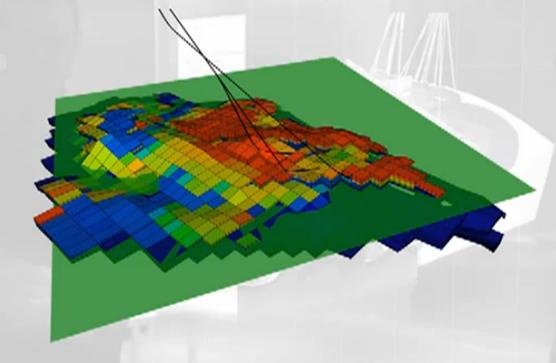
For those of us outside the oil & gas exploration and production business, the work that reservoir engineers do to maximize the probability of locating productive wells is truly amazing. Especially when the reservoir is located deep beneath the ocean floor, like the recently announced ExxonMobil Gulf of Mexico estimated 700 million barrel discovery.
Not being a reservoir engineer or a geologist, I still found a recent E&P magazine article, Bridging the resolution gap, by Emerson’s Tyson Bridger, quite interesting. Tyson highlights a large issue reservoir engineers face :
…updating an existing model to maintain model reliability whenever new data are acquired. Another challenge is to determine how to efficiently leverage all available data throughout the modeling process.
Not effectively incorporating this data can impact the fidelity of the reservoir model and reduce the productivity of the field or cause misplaced wells to be drilled. Tyson notes:
Property modeling is one area where seismic data can be combined with other data such as well data to generate accurate and well-constrained reservoir models.
The difficulty has been the differences in resolution between the data sets with the seismic data being much coarser. Tyson highlights the Roxar RMS2010 Sedseis property modeling tool, which:
…incorporate information derived from seismic directly into the facies [rock unit characteristics] model, bridge the gap between the seismic scale and the scale relevant to stochastic techniques, and ensure seismic data are integrated quickly and easily into the reservoir model.
This is achieved by blending data extracted from seismic with geostatistical tools such as guide lines and trends to generate well-constrained sedimentary bodies. This ability to bridge the gap between both deterministic and statistical techniques gives the modeler access to the gray area between seismic resolution and data-constrained statistical modeling, resulting in a more realistic property model conditioned to well observations and with accurate volume calculations.
 These 3D models and associated properties help with planning processes such as drilling locations, reserves estimation, and past and future production simulations.
Tyson also describes a multipoint statistics (MPS) technique, which:
…allows the reservoir engineer to condition 3-D training images of the interpreted heterogeneities in the reservoir in addition to wells and seismic.
The end of result of these tools is easier incorporation of new seismic, well, and other information to improve the robustness and reliability of the models. This helps from the exploration end through the oil production facilities planning and the ongoing life of the wells. If you’re interested in further information, there is a 6m:25s RMS 2010 YouTube video showing these tools in more detail.
